Tom, Dick and Harry Mt. SOTA activation, Field Day 2024
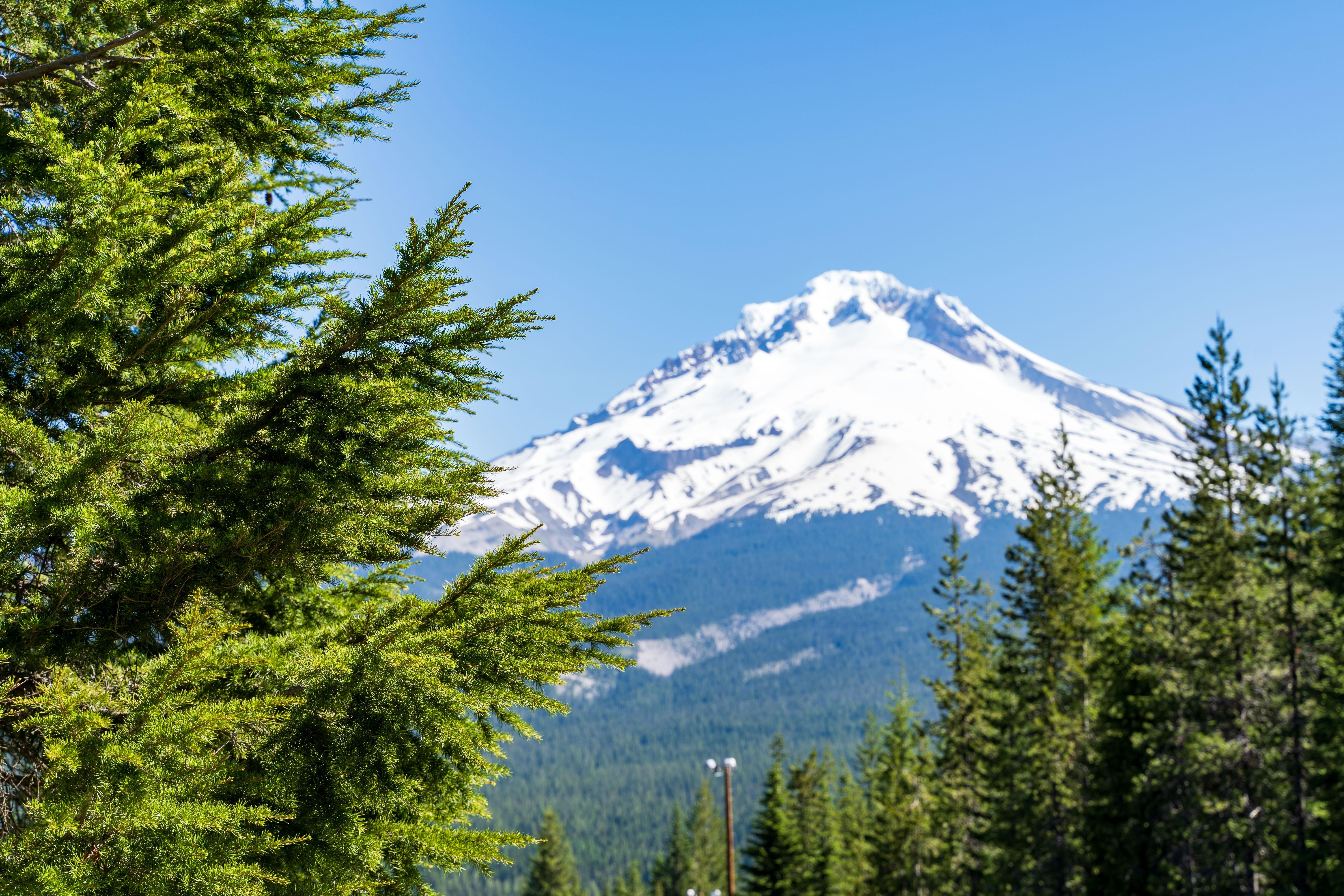
This is the Field Day time of the year and as it is customary already, I present you with a new SOTA activation report. My quest for the mountain goat brings us to Oregon, to the foothills of the Mt. Hood. Hiking to the summit of Tom, Dick, and Harry Mountain, also known as W7O/CN-032, is a nice half-day activity, and the vistas of Hood are probably the best one can get (given you chance upon a clear day) .
Mt. Hood view from Tom, Dick and Harry mountain
A wee bit of history
The first recorded peoples populating the area near Mt. Hood were Clackamas and probably other Chinookan peoples. First contact with europeans occurred during the Lewis and Clark expedition.
By 1846, with numbers of settlers traveling to the fertile Willamette valley increasing, the need for a land based wagon route was clear. Up until this point, immigrants traveled with wagons to The Dalles on the Columbia River, disassembled wagons, made rafts and floated belongings down to Fort Vancouver. This was expensive and dangerous. Today, the Cascades Rapids are submerged after the construction of the Bonneville Dam. But in the 19th century, the river dropped here about 40 feet (12 m) in 2 miles (3.2 km) and ran through a stretch approximately 150 yards (140 m) wide. Rafts had to be unloaded and carefully lowered on ropes, and all equipment had to be ported around the rapids. Conflicts with Native Americans hostile to the invading settlers were common.
This motivated Sam Barlow to construct Barlow road, providing an overland route to the Willamette valley. While easier than the river route, Barlow Road was still the most arduous leg of the Oregon trail. Both people and animals were exhausted by the time they got here; pioneer cemeteries along the road are a silent reminder how hard the travel was back then. The crux of the Barlow Road was getting down the Laurel Hill. Logs were dragged to slow down wagons navigating steep chutes, and chain and rope winches were also used. You can hike the old chute. In 1861 a better road was blasted though the hill.
In 1849, a military wagon train destined for Oregon forts passed over the road. It carried 230 tons of munitions in more than 400 wagons pulled by 1700 mules. From the beginning of Barlow Road to the camp the soldiers made at what has been known since as Government Camp, they abandoned 45 wagons after dozens of mules died of starvation.
Now it takes about an hour to reach the village of Government Camp from Portland via Hwy 26.
Among the other interesting things in the area is historic Timberline Lodge, which was used to film exterior shots of the Overlook Hotel in Stanley Kubrick’s The Shining.
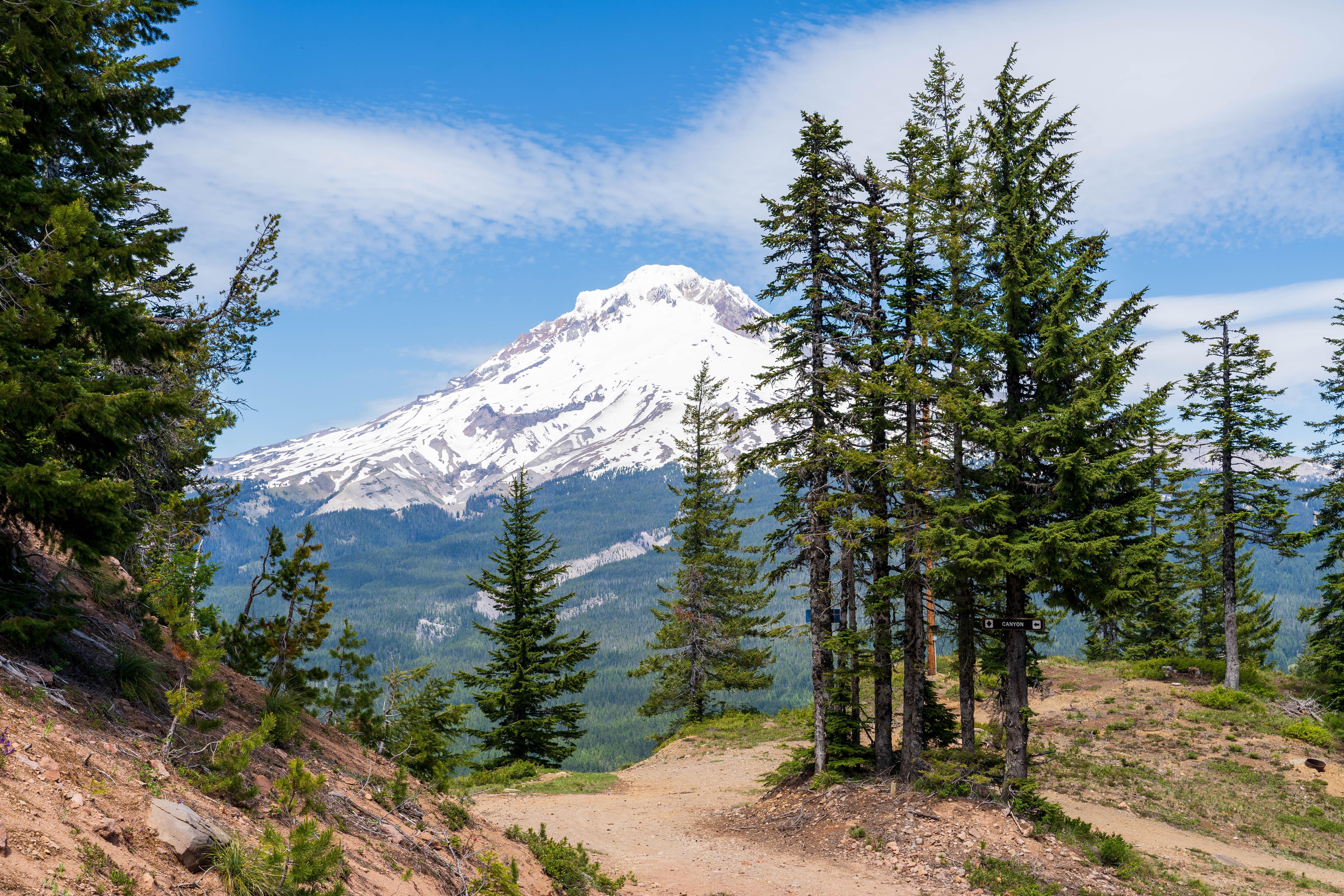
The hike
The mountain is named for its three distinct peaks along the summit, forming the cirque that is now part of the Mount Hood Skibowl ski resort. The mountain has been called “Tom Dick Mountain” in the past, but the Board on Geographic Names officially decided to include “Harry” in 1969, making the mountain’s name a play on the phrase “Tom, Dick, and Harry,” a placeholder for a few unspecified people.
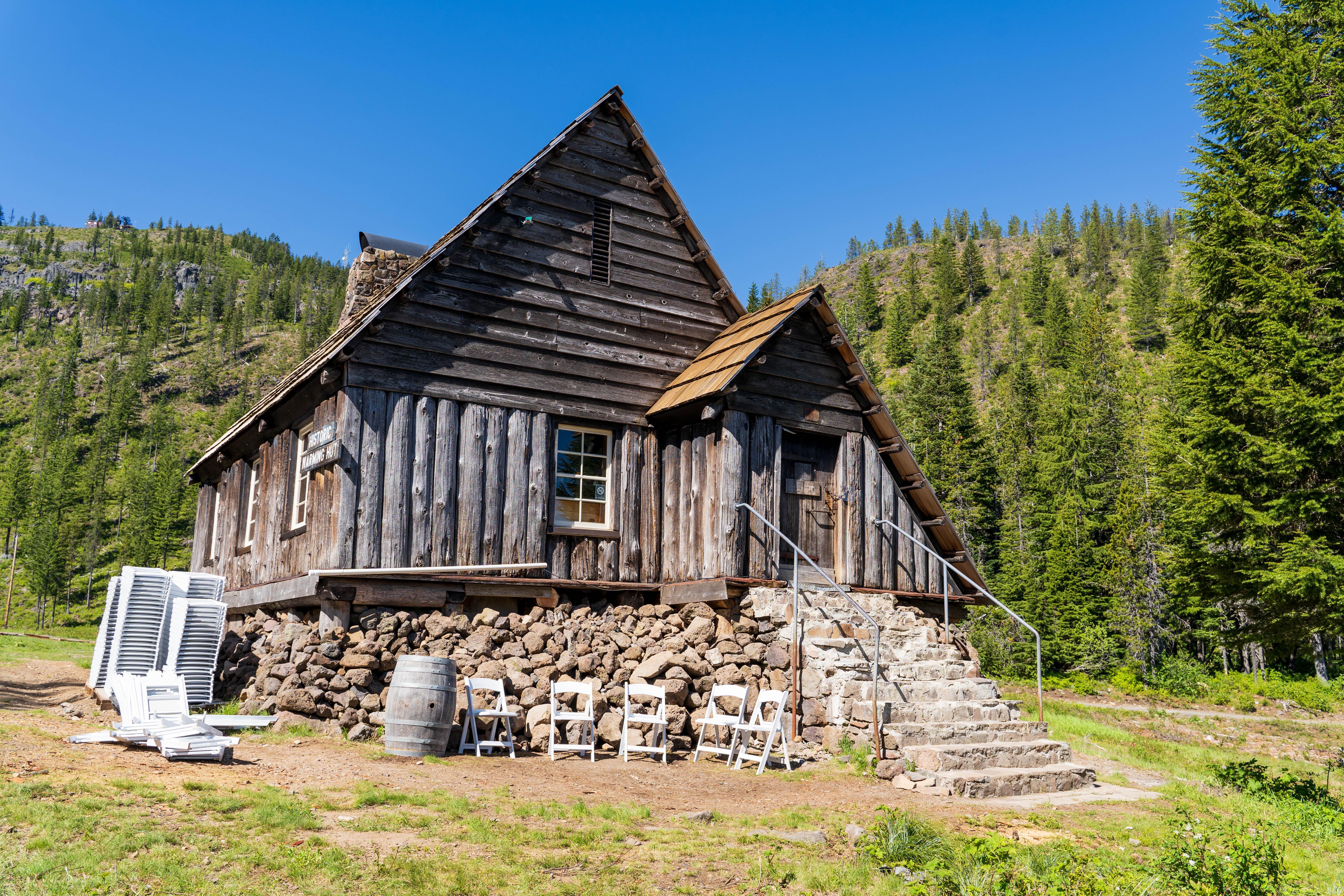
Historic warming hut
The trails you can take to the summit start in or near Government Camp. You can either do a loop or an out-and-back trail. Elevation gain from the parking lot is approximately 1,700 ft (518 m).
The trails are quite well-shaded; the mountain is forested all the way to the top.

Rhododendron bloom
The end of June is when rhododendrons here start to bloom. I also saw a lot of blooming wild strawberries and many huckleberry shrubs—hiking later in the season may be yummy!
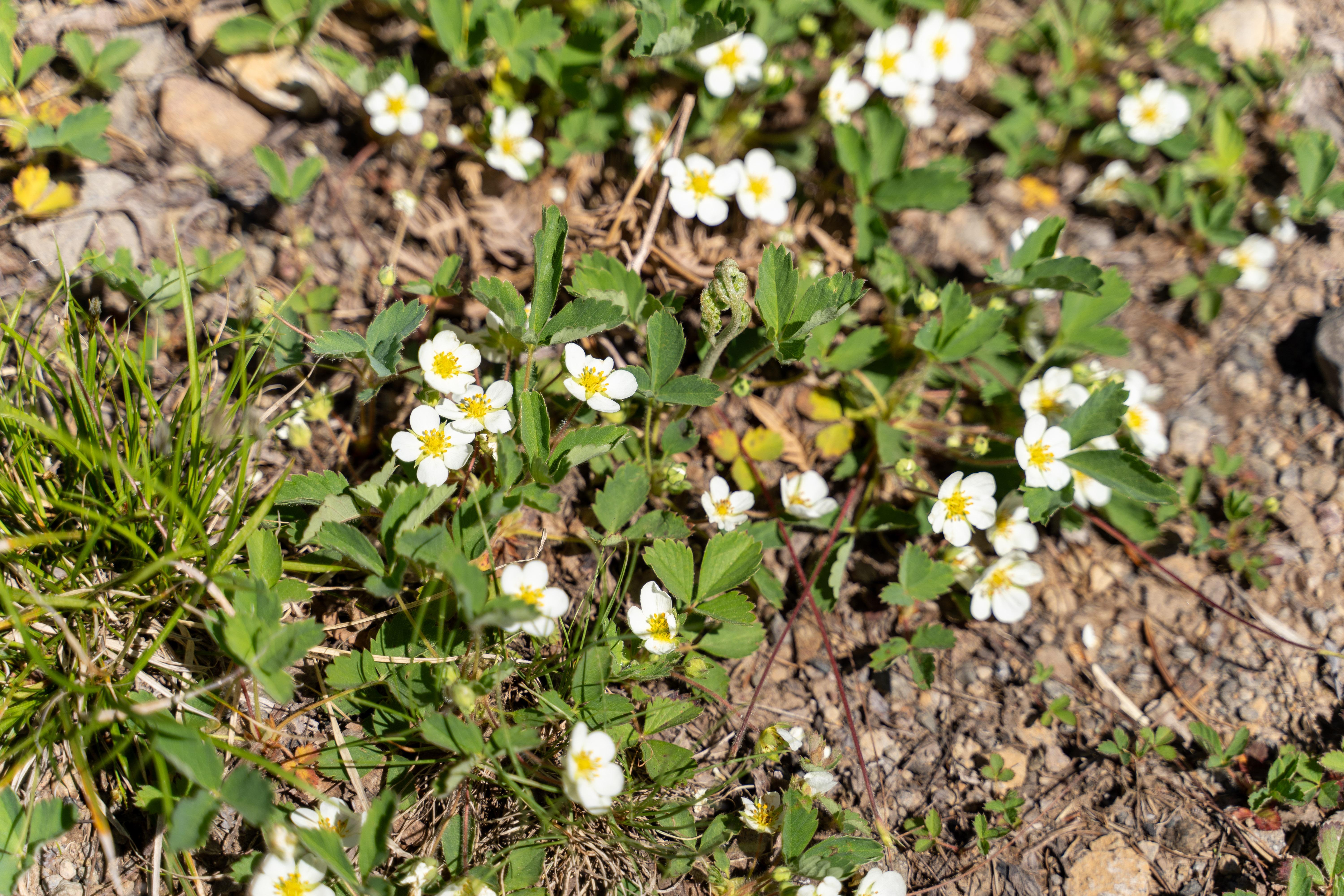
Wild strawberries
Tom, Dick, and Harry Mountain, aka W7O/CN-032 SOTA activation
Cell phone coverage is good. There is a seismic activity monitoring station on the summit, powered with a solar panel. The summit meadow is quite big and flat, had no problem deploying the dipole. Also there are some logs one can sit on.
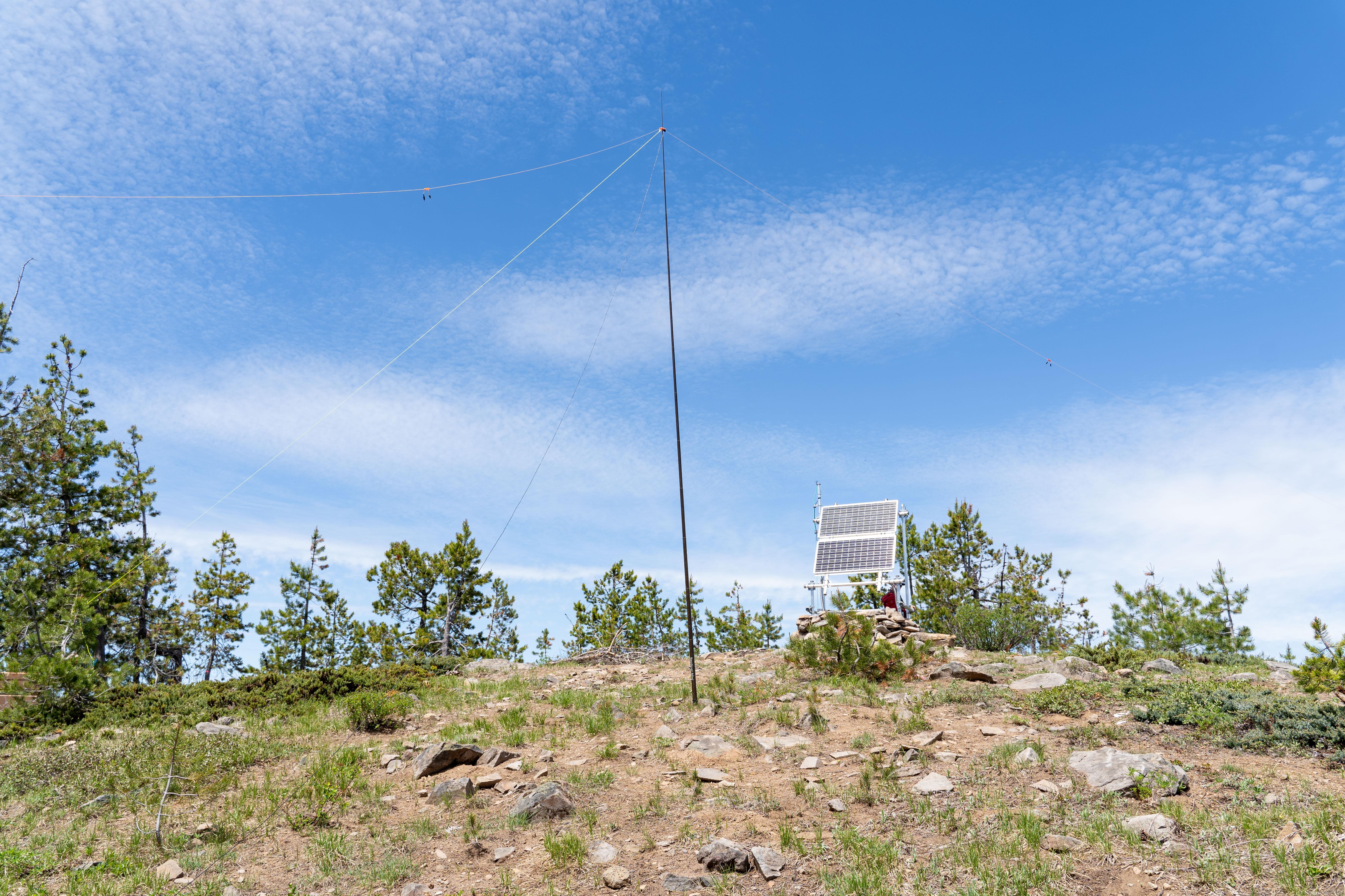
Summit meadow
To be honest, I am quite underwhelmed with my activation. On top of getting a bit rusty with Morse code, I was clearly lost in a pile-up. I heard a ton of people, but despite seeing my spots on the SOTA watch site, few people could actually hear me. Those who did hear reported a very poor signal. I need to take a closer look at my dipole antenna—probably it’s time to replace it. But anyway, I made four contacts, including a summit-to-summit one, so the mountain is activated.
Stations worked from the summit
Thanks to all the chasers!
| Time UTC | Call sign | RST sent | RST received | Frequency | Mode | Maidenhead grid |
|---|---|---|---|---|---|---|
| 18:50 | K7RK | 559 | 559 | 14.063 | CW | CN88 |
| 19:00 | VY1JA | 559 | 559 | 14.063 | CW | CP20 |
| 20:00 | KN6RDC | 559 | 519 | 14.063 | CW | s2s W6/SC-371 |
| 20:20 | K6HPX | 559 | 519 | 14.063 | CW | DM42 |
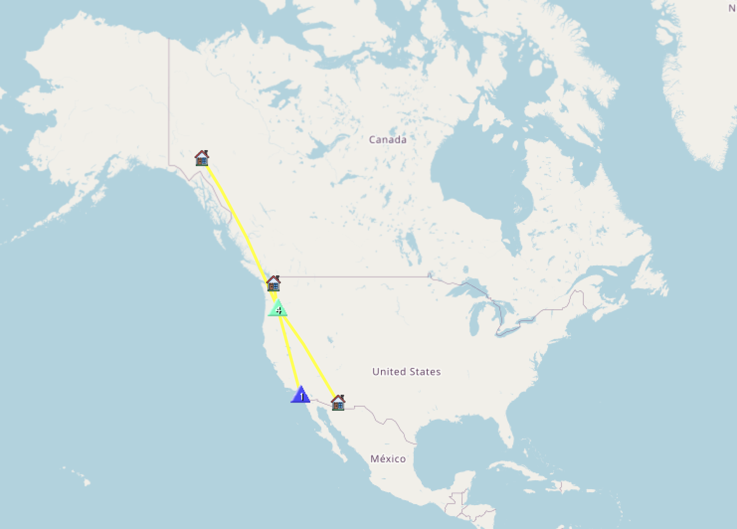
Contacts map
This is it for now, 73, K0SSK out.