Round Top SOTA activation 2022-08-07
Hi folks, it’s time for another activation report. Wanted to do some summit with a scenic approach and somewhat interesting mountaineering wise. This is why I chose Round Top aka W6/NS-055. The mountain is located right above Carson Pass in Sierra Nevada and quite close to Kirkwood ski resort.
I can’t recall when I was in the area last time - quite possibly never as I tend to take hwy 50 or hwy 120 to eastern Sierras. Was not disappointed and probably going to visit again soon.
The area is rife with early pioneer landmarks and I feel I learned a lot about early history of California following the stories behind them.
A rant
As I mentioned elsewhere in this blog I am myself a transplant to California and stories about the early exploration and European settlement excited me early on. What is even more fascinating is that there are still places here where you can be one with Nature as if it is the nineteenth century. I am forever grateful to the people who keep the backcountry wild.
As time passed however my perspective on the history of California shifted quite a bit. There is quite a bit of a dark undercurrent once you dive deep enough. We know the history is written from the winner’s perspective and all winner stories suffer from a survivor bias.
Taking hwy 88 provides you with some somber reminders - 1) you can’t bullshit a mountain 2) California was the wildest of the west back in the day.
A wee bit of istory
Maiden’s grave
One of the places I visited is Maiden’s grave. Designated as the California Historical Landmark No. 28 marker reads
BROKEN DREAMS AND HOPE, CARRIED 2000 MILES THROUGH SCORCHING DESERTS AND OVER LOFTY MOUNTAINS. AT LAST… THE SIGHT OF THE PROMISE LAND. THOSE WHO VISIT THE GRAVE CARRY THE TORCH OF LOVE AND HOPE (WHICH THIS YOUND GIRL LOST), AND PASS IT ON, TO GENERATIONS UNBORN. RECHALL MELTON WAS LAID TO REST HERE, ON A COLD AND FROSTY MORNING, OCT. 4, 1850. BLESSED ARE THE PURE IN HEART FOR THEY SHALL SEE GOD.
There is a good article on Calexplornia providing much details about the story. In a nutshell, the 1849 California gold rush caused a large influx of immigrants from eastern states. Rechall Milton was a member of a party trying to cross Sierra Nevada via the Mormon Emigrant Trail and unfortunately succumbed to illness and was buried not far from the current marker.
By no means extraordinary this death on the doorstep of the golden state definitely enriched the dark frontier lore and romance. It appears the real person in the grave is one Allen Melton and the real maiden’s grave is some distance away on a private property.
Tragedy spring
Link to the place location on Google maps. As the Wikipedia article says
In 1848 a company of Mormons, some of whom had served in the Mexican–American War as part of the Mormon Battalion, were planning to leave the recently discovered gold fields near Placerville to join the new Mormon colony at Salt Lake City, Utah. Daniel Browett, president and lead scout of the Browett-Holmes Company, decided to ride out with two companions and scout snow conditions and a possible route over the Sierra Nevada against the advice of the rest of the company. When the scouts hadn’t returned by July 5, a party of 10 went in search of them without success. On July 19, the main group, now on its way to Utah, arrived at the spring and found a freshly dug shallow grave with broken arrows lying about. Upon investigation, they found their scouts' bodies in the grave, whereupon they named the spring “Tragedy.” The victims had been stripped, mutilated and robbed, according to journal accounts.
Another good article about the tragedy on Calexplornia site.
Carson pass
Kit Carson was a legend during his life already. Fur trapper, wilderness guide, Indian agent, U.S. Army officer, main character of dime novels, genocidal maniac - everything neatly rolled up into one figure.
On the parking lot you start the hike from there is a monument to the tree Kit Carson scrawled his name on while being a part of Frémont’s second expedition into California. I find it quite hilarious that Kit made a mistake writing his own name by missing the “i” letter - and this inscription is now preserved for later generations in bronze.
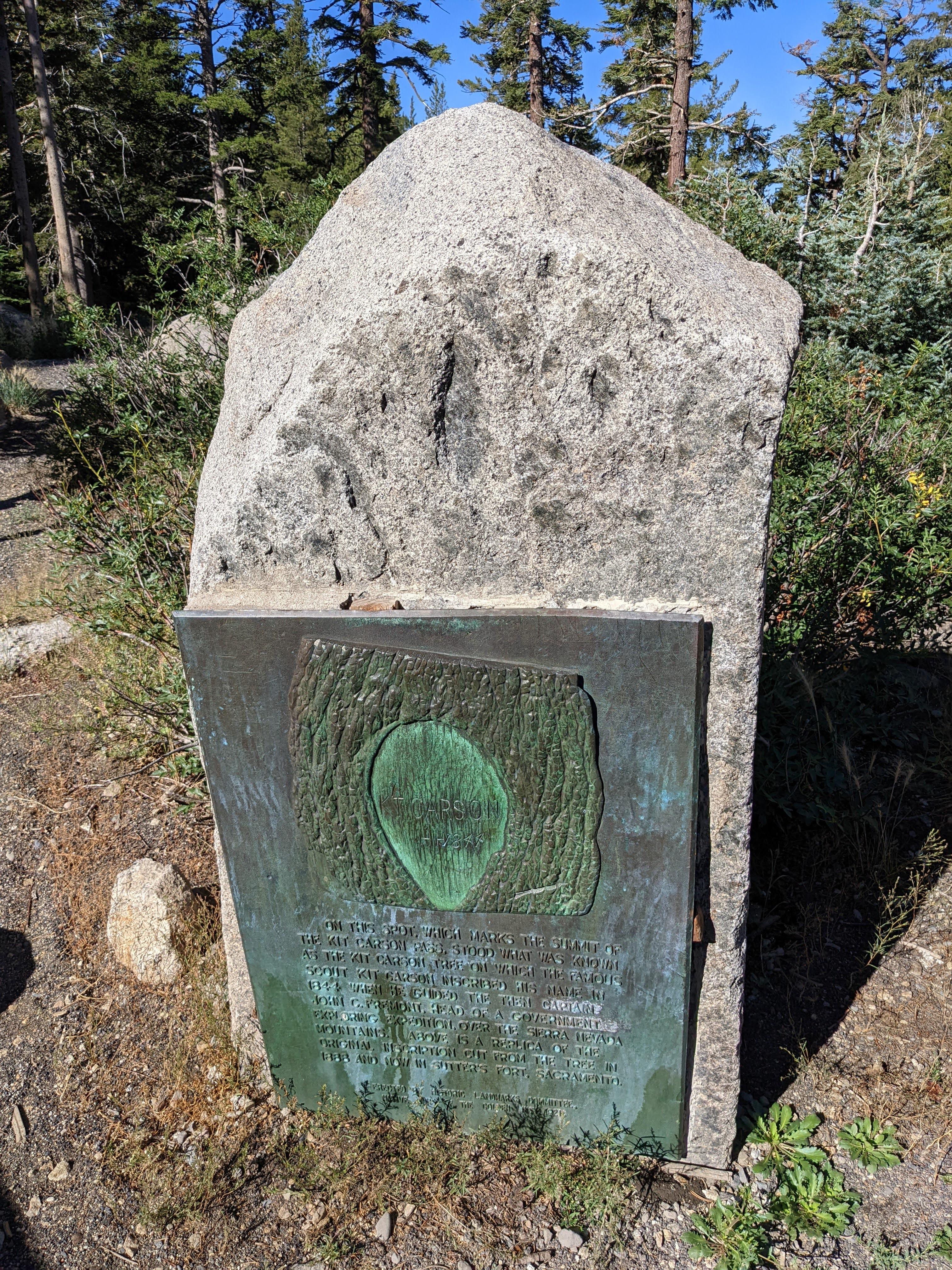
Kit Carson pass - a monument to the tree Kit Carson scrawled on back in 1844
A polarizing figure to say the least. Highly recommend checking the Wikipedia article and make your mind up yourself - there are plenty of leads to follow there.
The hike map and timings
Mokelumne wilderness is definitely worth visiting. Start early because finding parking after 0900 can be sketchy and you don’t want to be caught high up on the mountain in an afternoon thunderstorm. I would recommend camping in the area if you were able to book a spot.
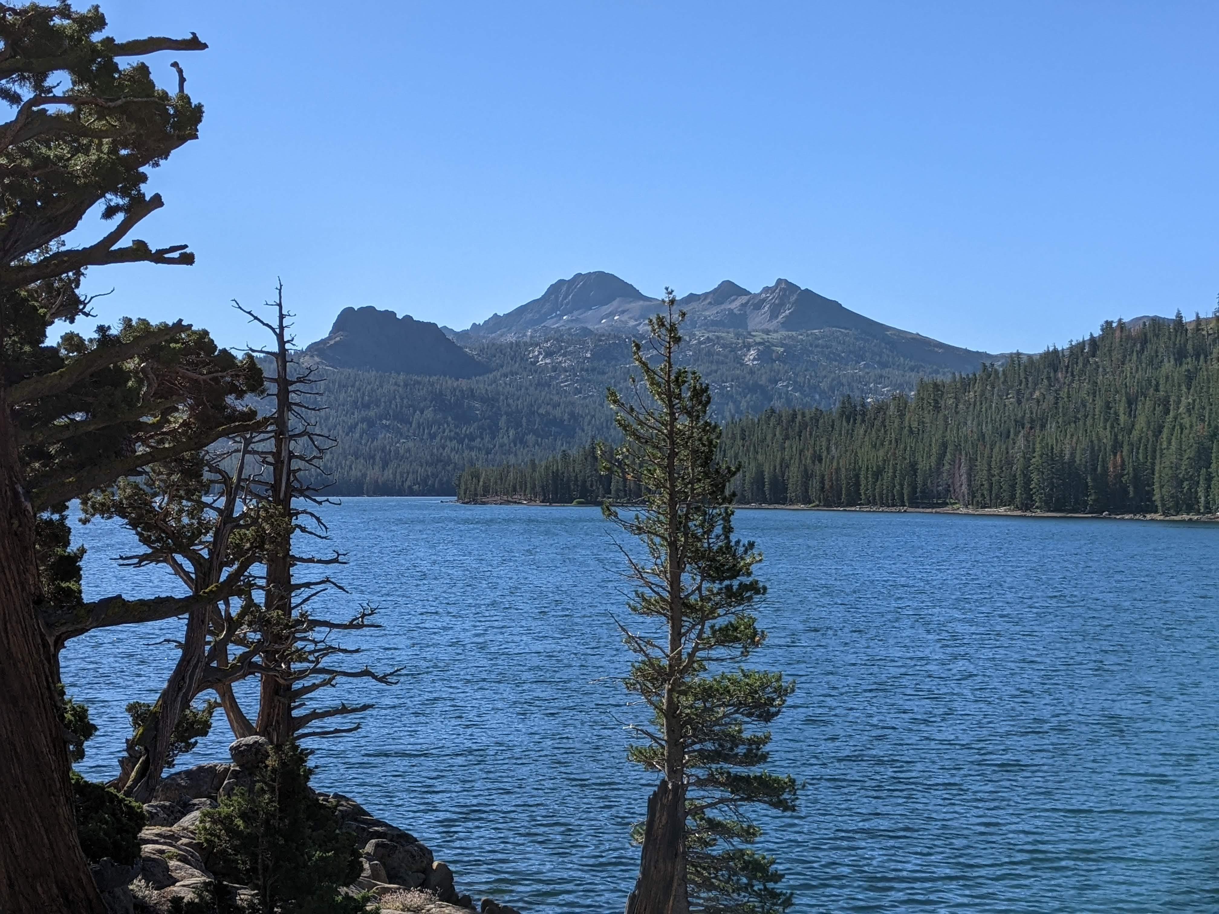
Black Butte and Round top as seen from the shore of Caples lake
Here is my trek on Gaiagps - has the elevation profile, times etc.
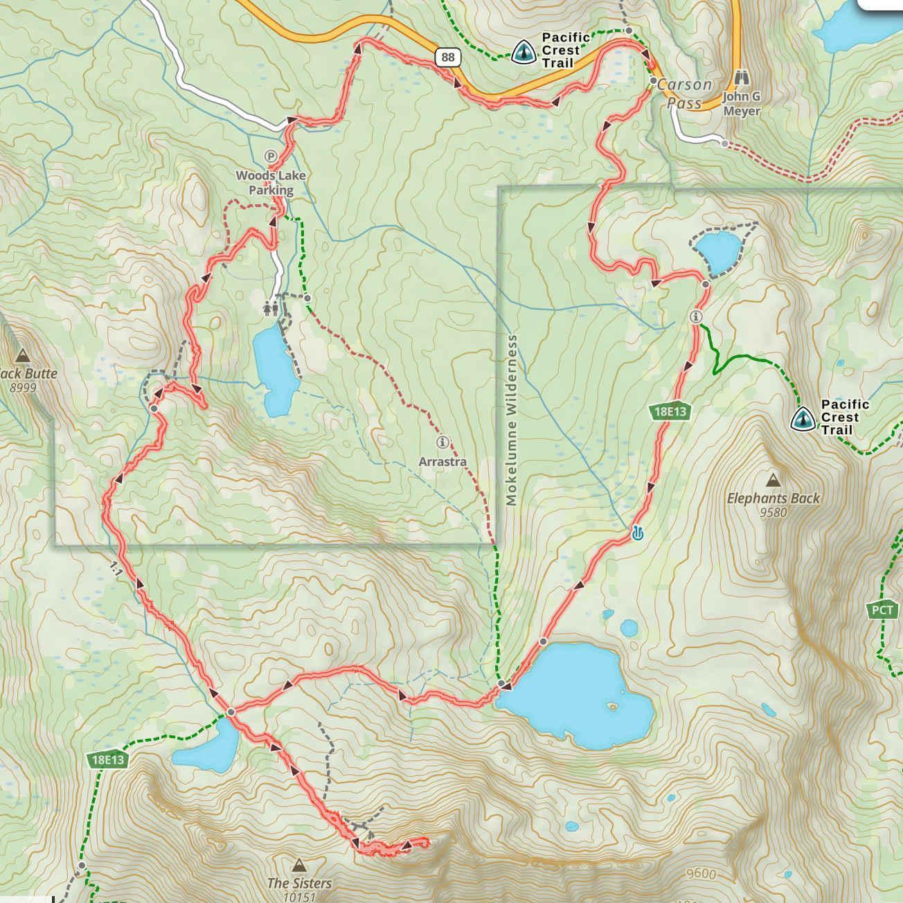
Hike map - did it clockwise starting fromthe Carson Pass parking lot
Moving time is four hours twenty minutes. I generally plan my hikes involving 2000 ft and more of elevation gain with a 20 lb backpack assuming a pace of one mile per hour. In this particular case the whole 9 mile hike with SOTA activation, rest and just-chilling-in-the nature breaks took seven hours twenty minutes. Close enough for me.
Let’s go already!
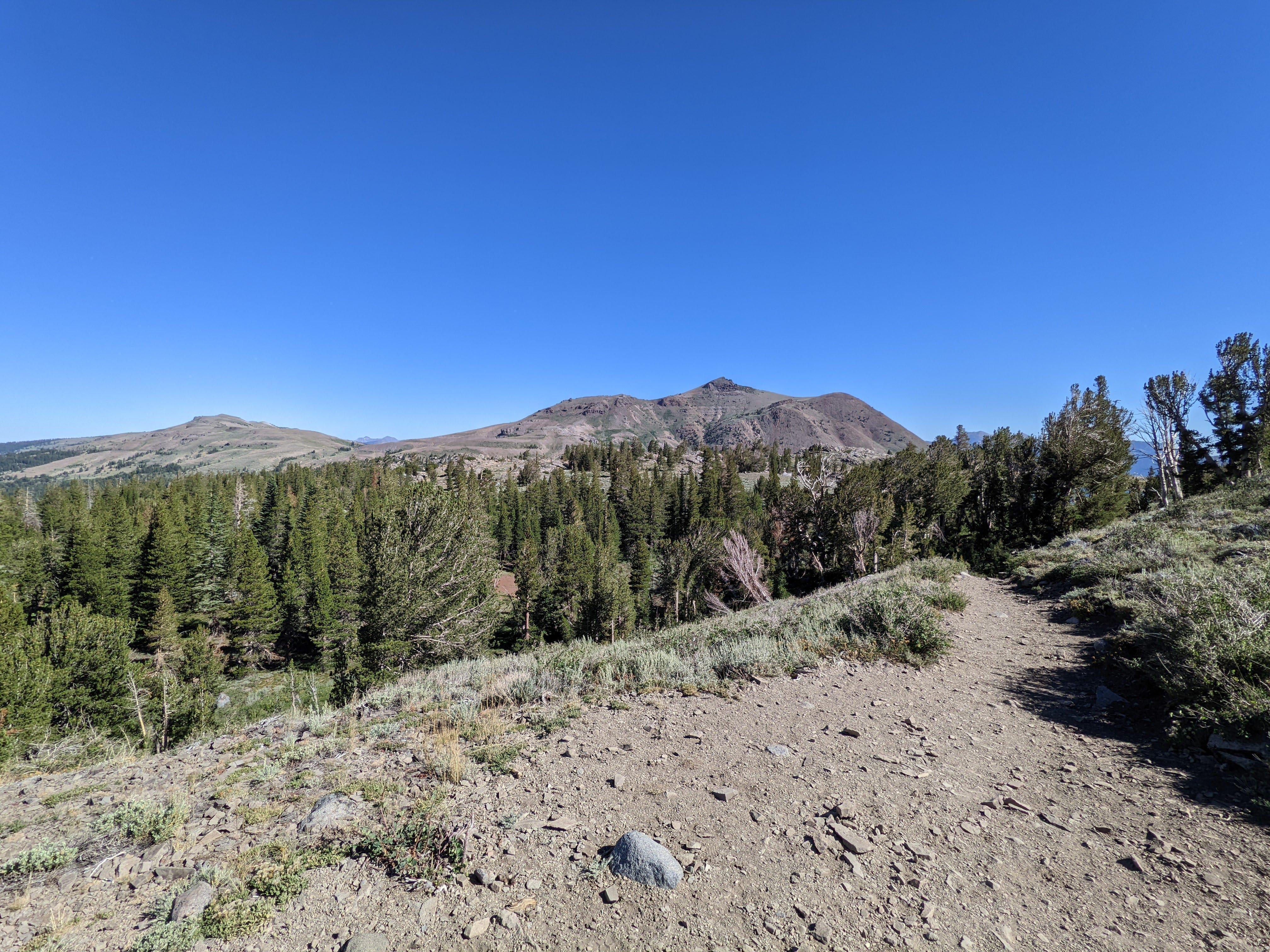
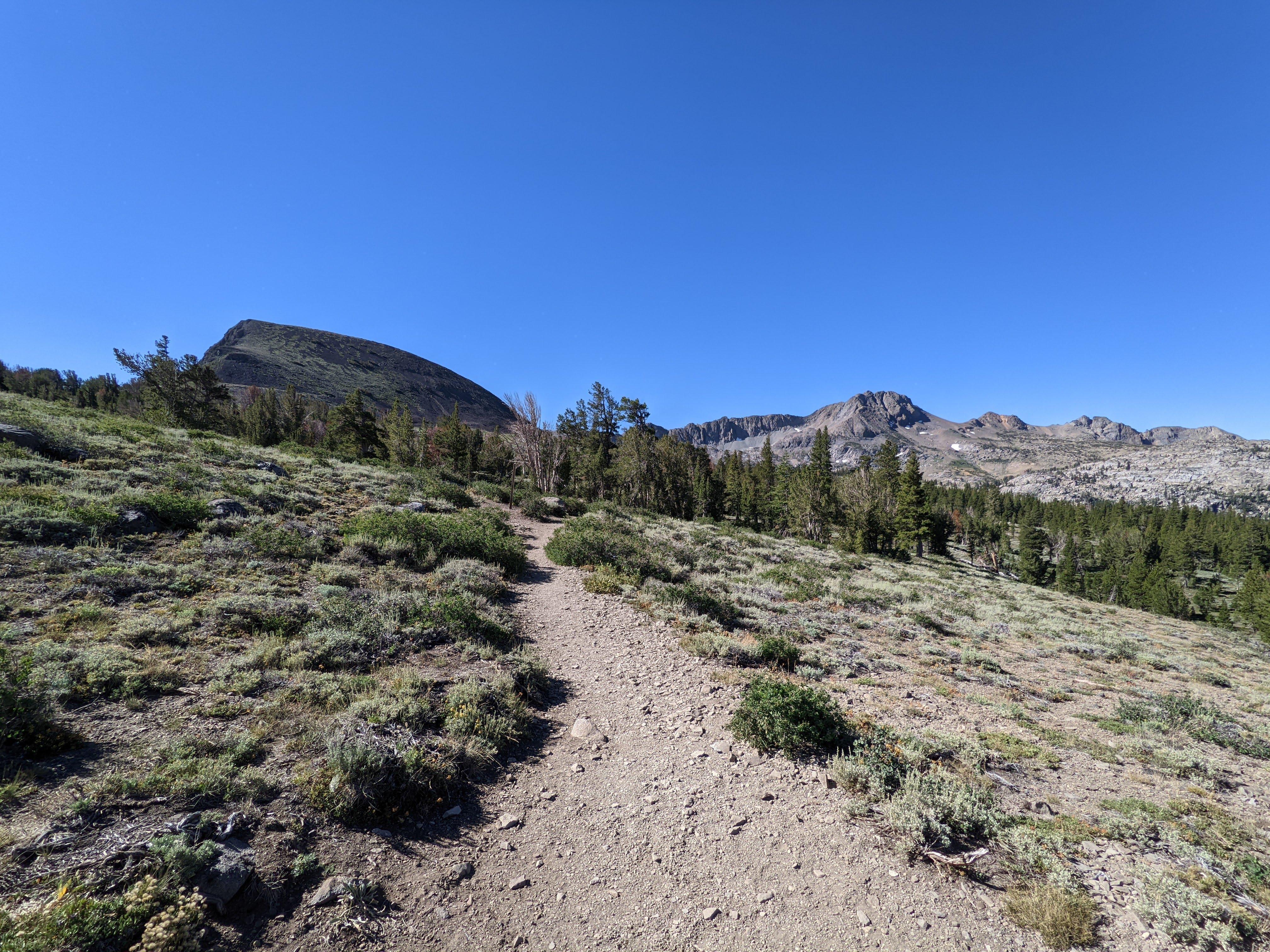
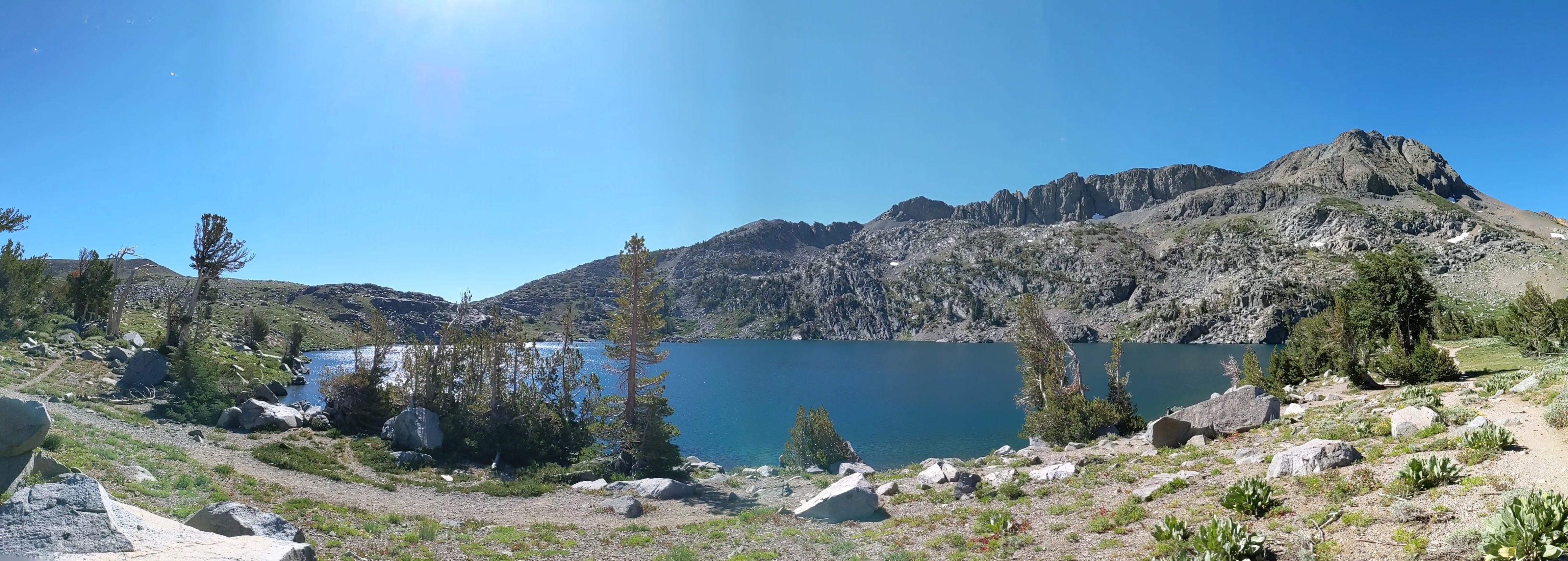
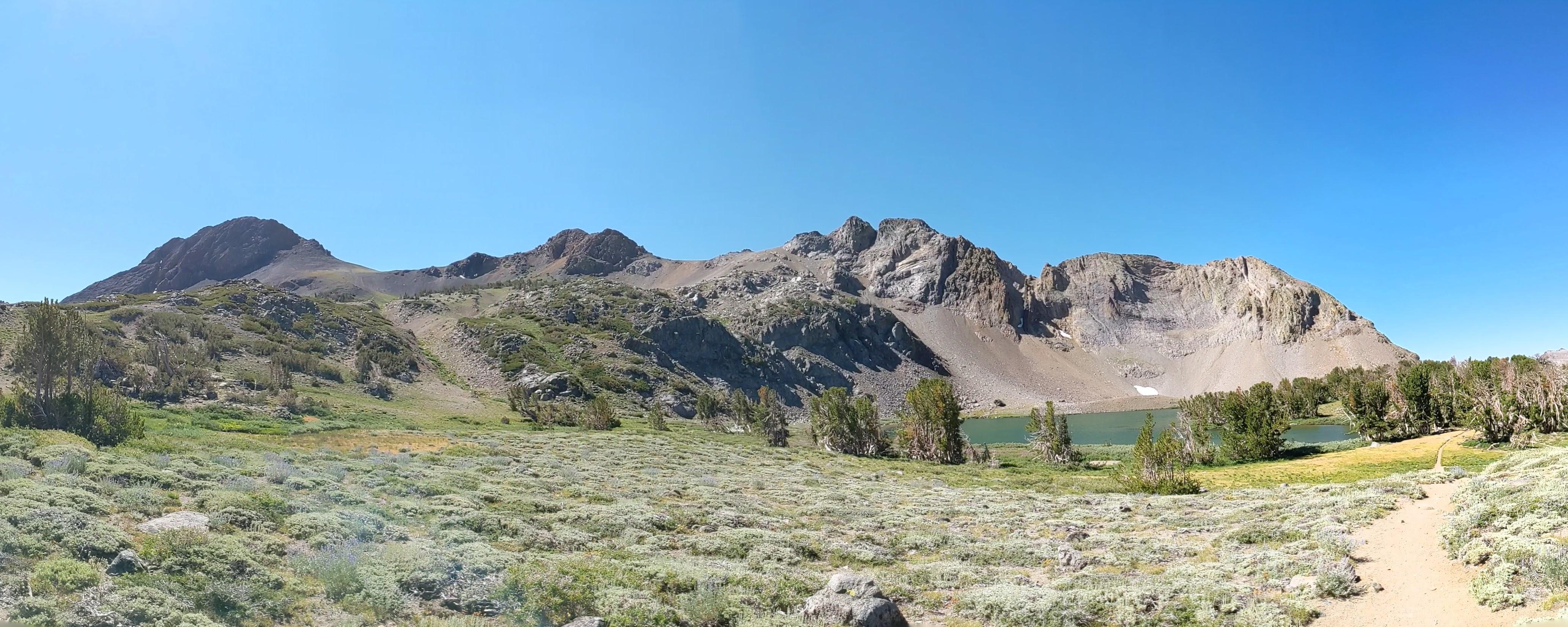
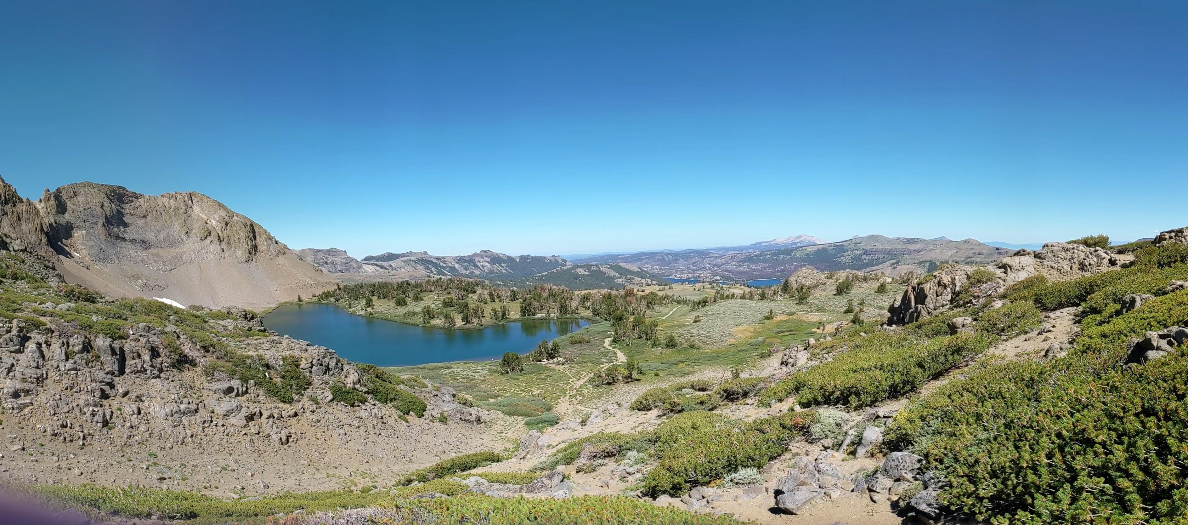
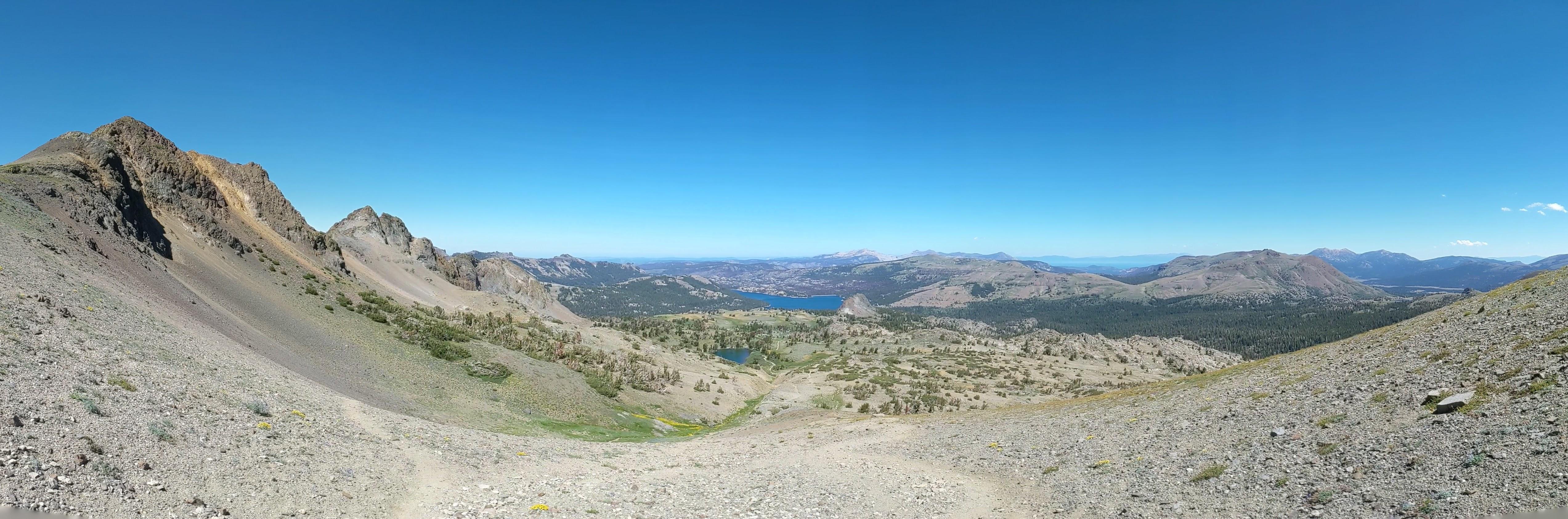
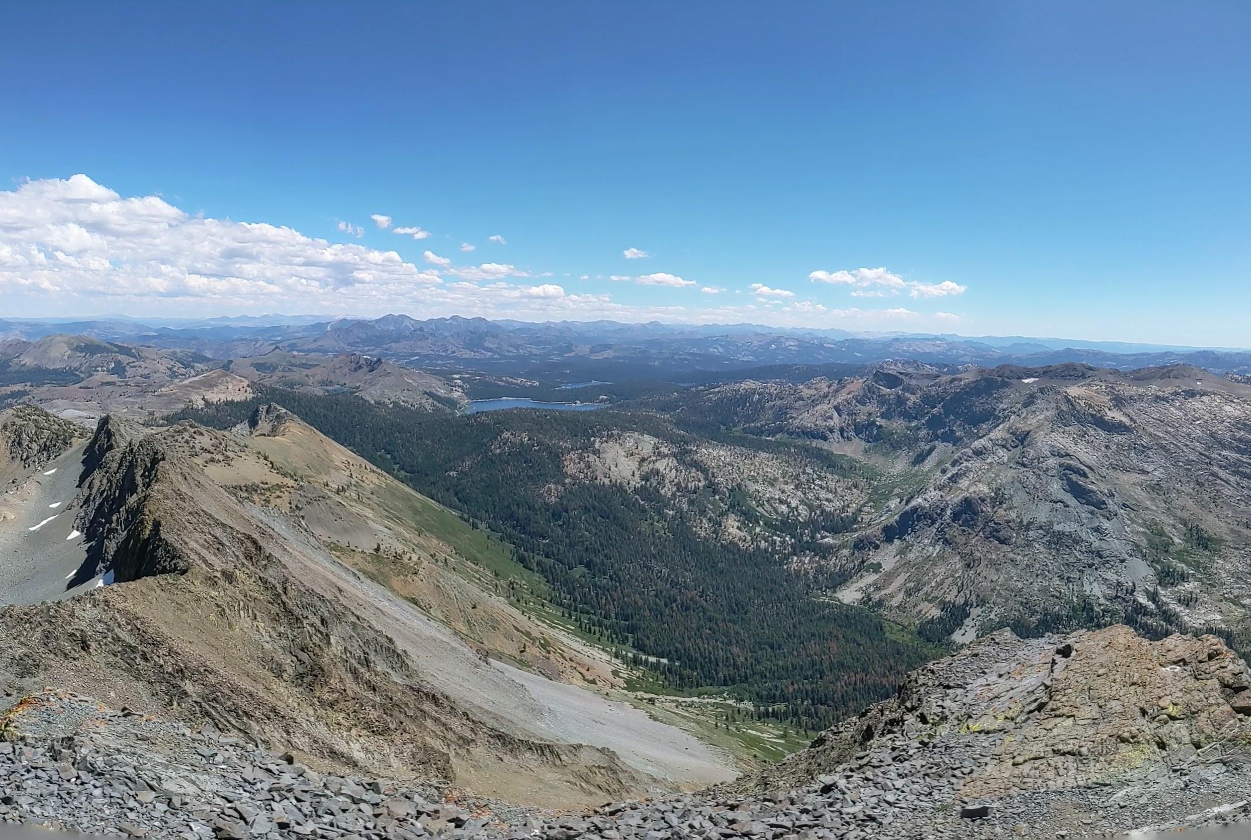
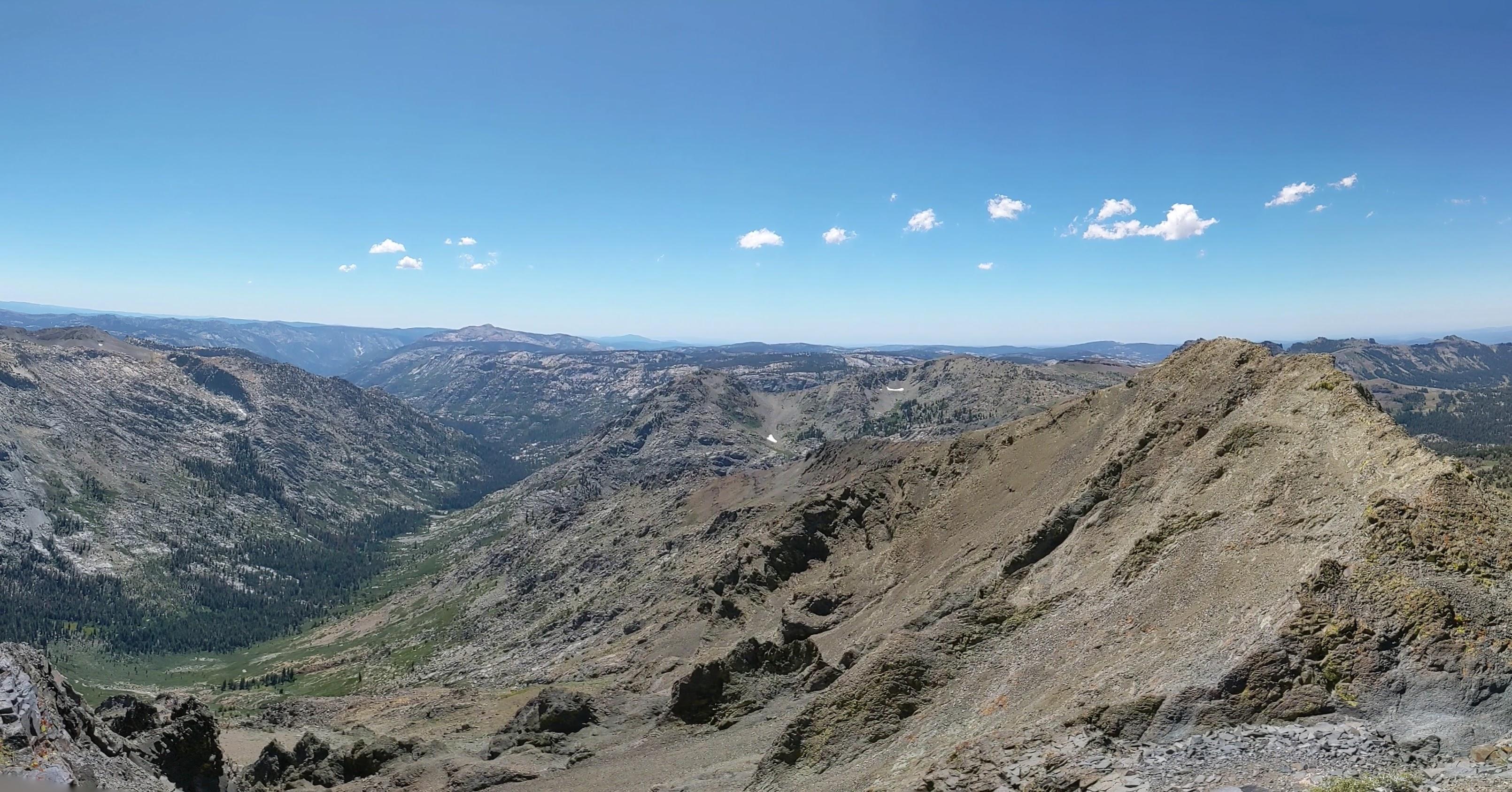
Carson pass parking around 0900 Red Lake Peak catches an eye in the northern part of panorama From left to right - Elephant’s back, Round Top, The Sisters Winnemucca lake and Round Top Round Top, The Sisters and Round Top Lake As you climb above Round Top Lake there are no more trees And as you go even higher there is no vegetation at all High Desert - Short before noon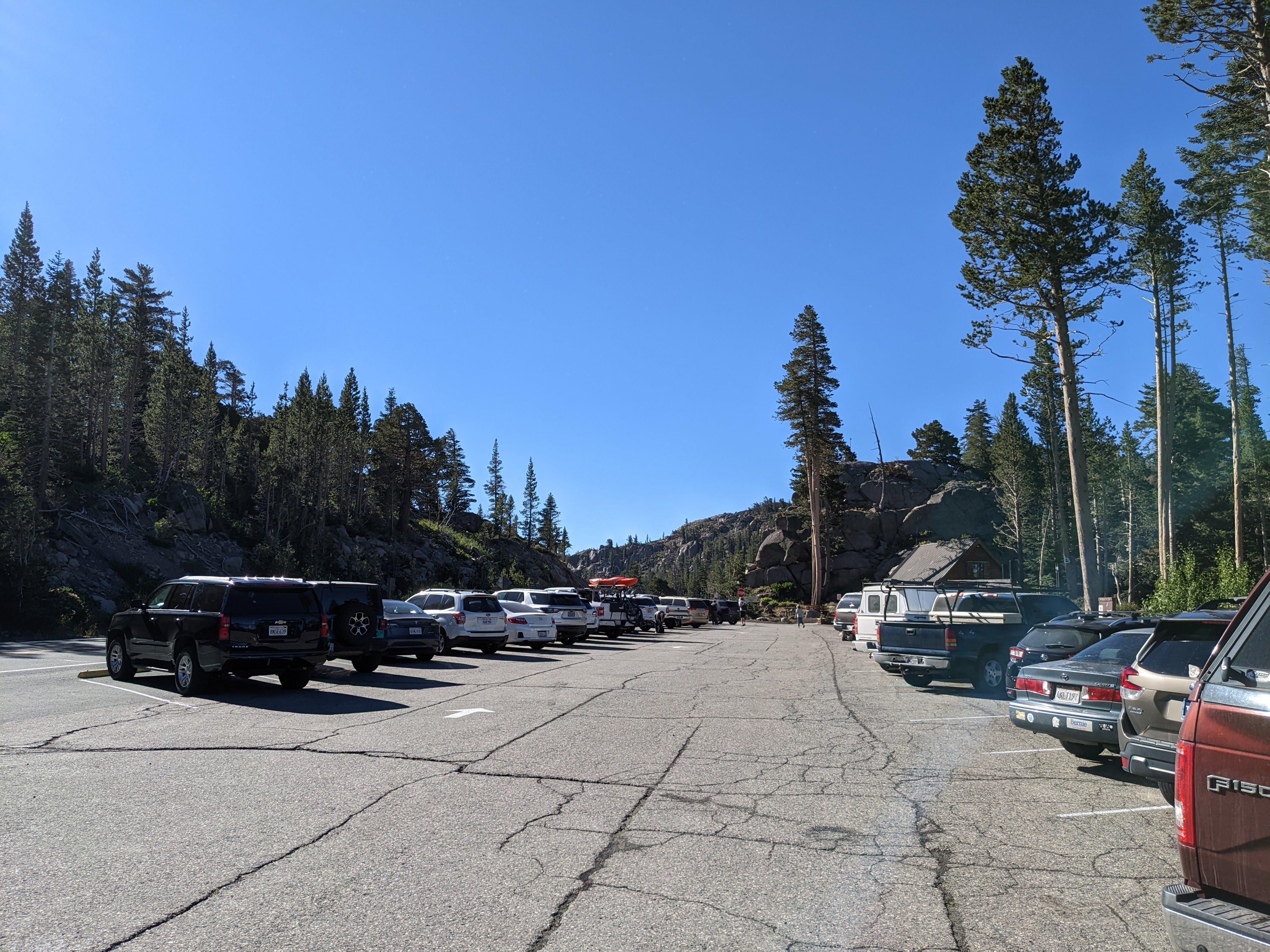
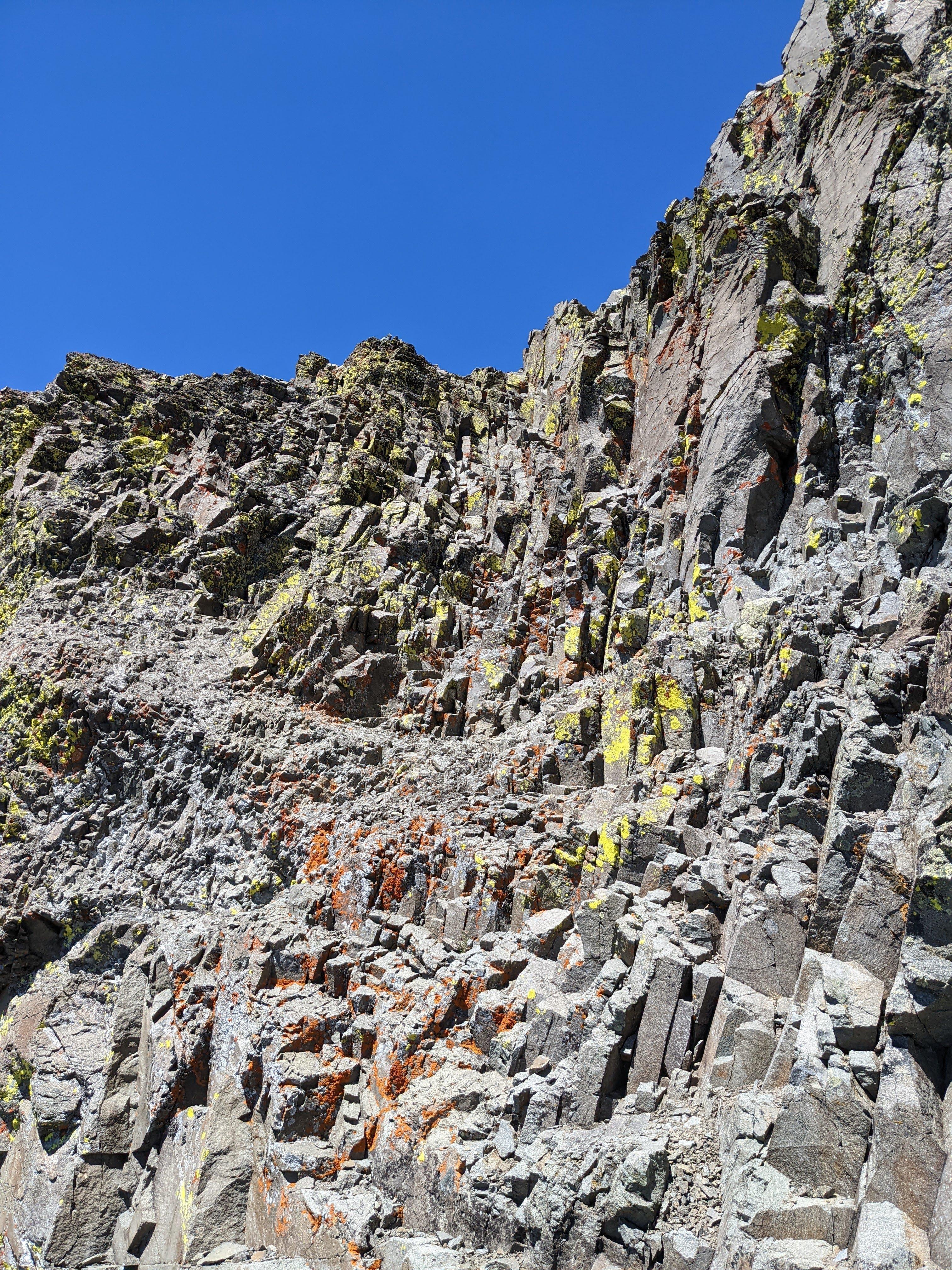
The mountain itself is what remains of an old volcano plug. I believe the blocky rock weathering patterns on the summit photos below hinting magma cooled fairly slowly otherwise crystals would be smaller but I am no geologist.
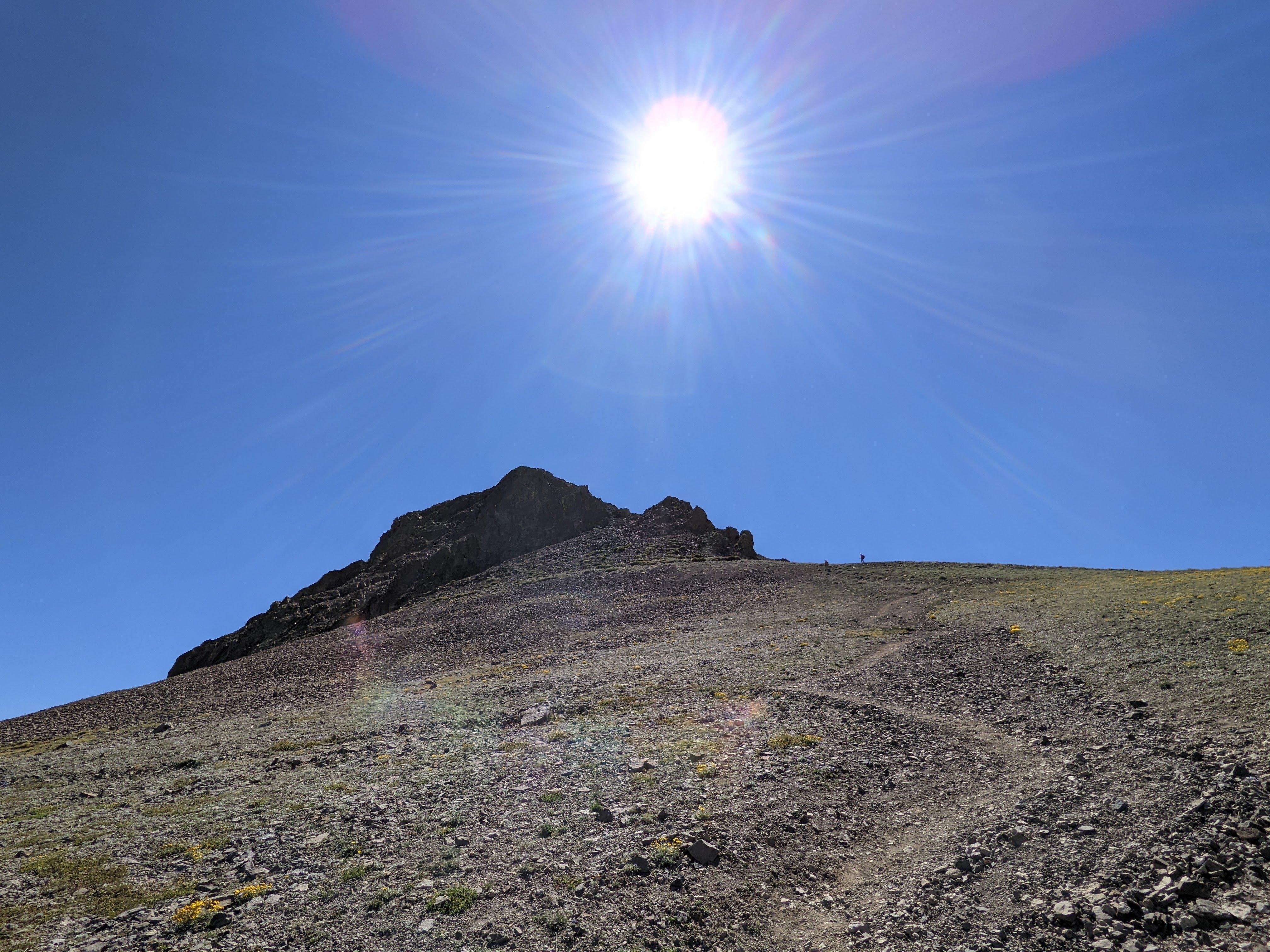
Do note - the photo below shows the crux of the trail - you need to cross this scree filled gulch and scramble up a fairly steep incline with a lot of exposure. If you are hiking solo but saw other people behind you on the trail it makes sense to band together just in case of emergency - as I did. Also remember there are way more routes you can climb up than routes you can climb down. Don’t be bold / dumb / hurt.
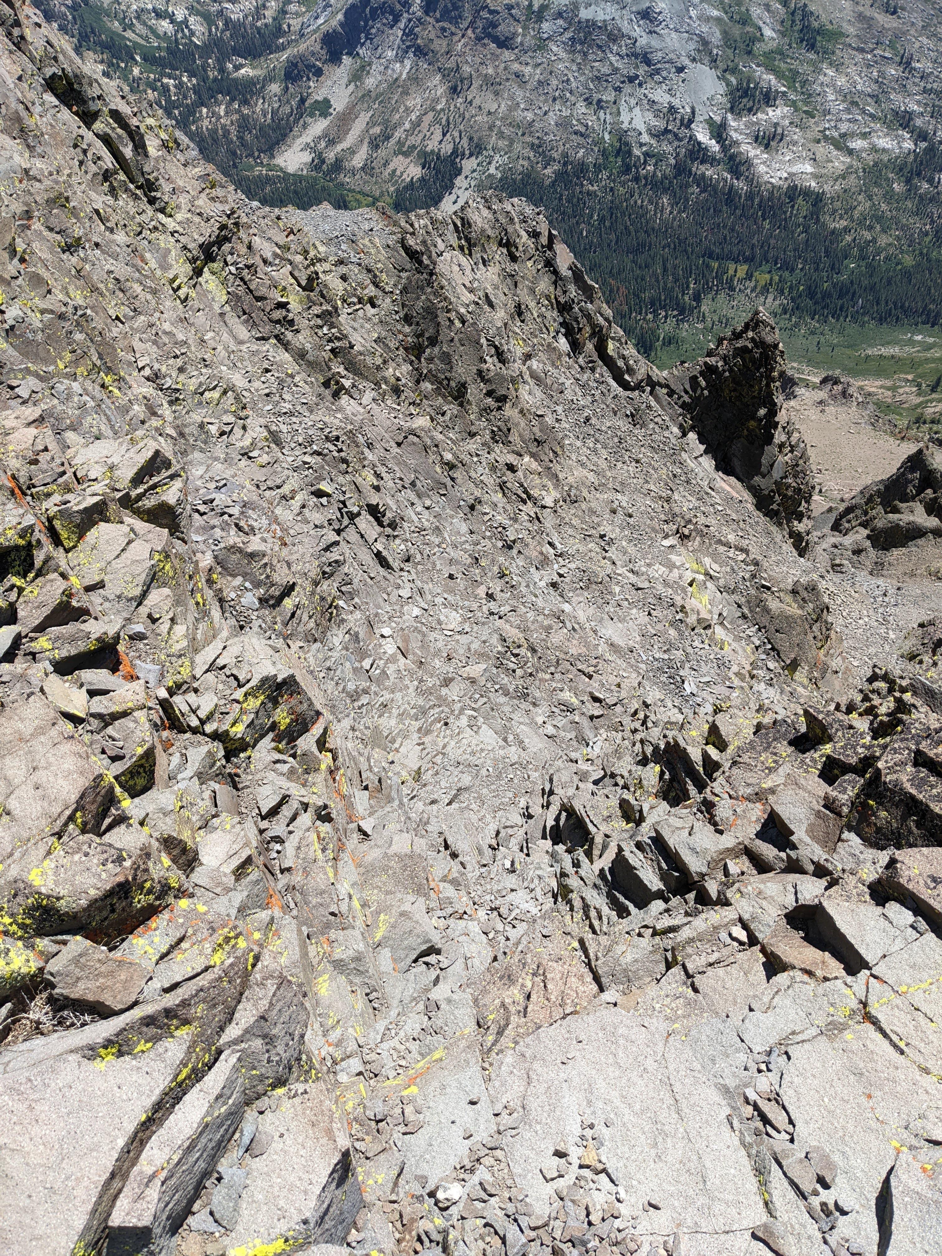
Definitely quite a bit of exposure here, lot of loose scree. Be careful Right below the summit there is a steep part Same terrain as on the photo above, as seen from the summit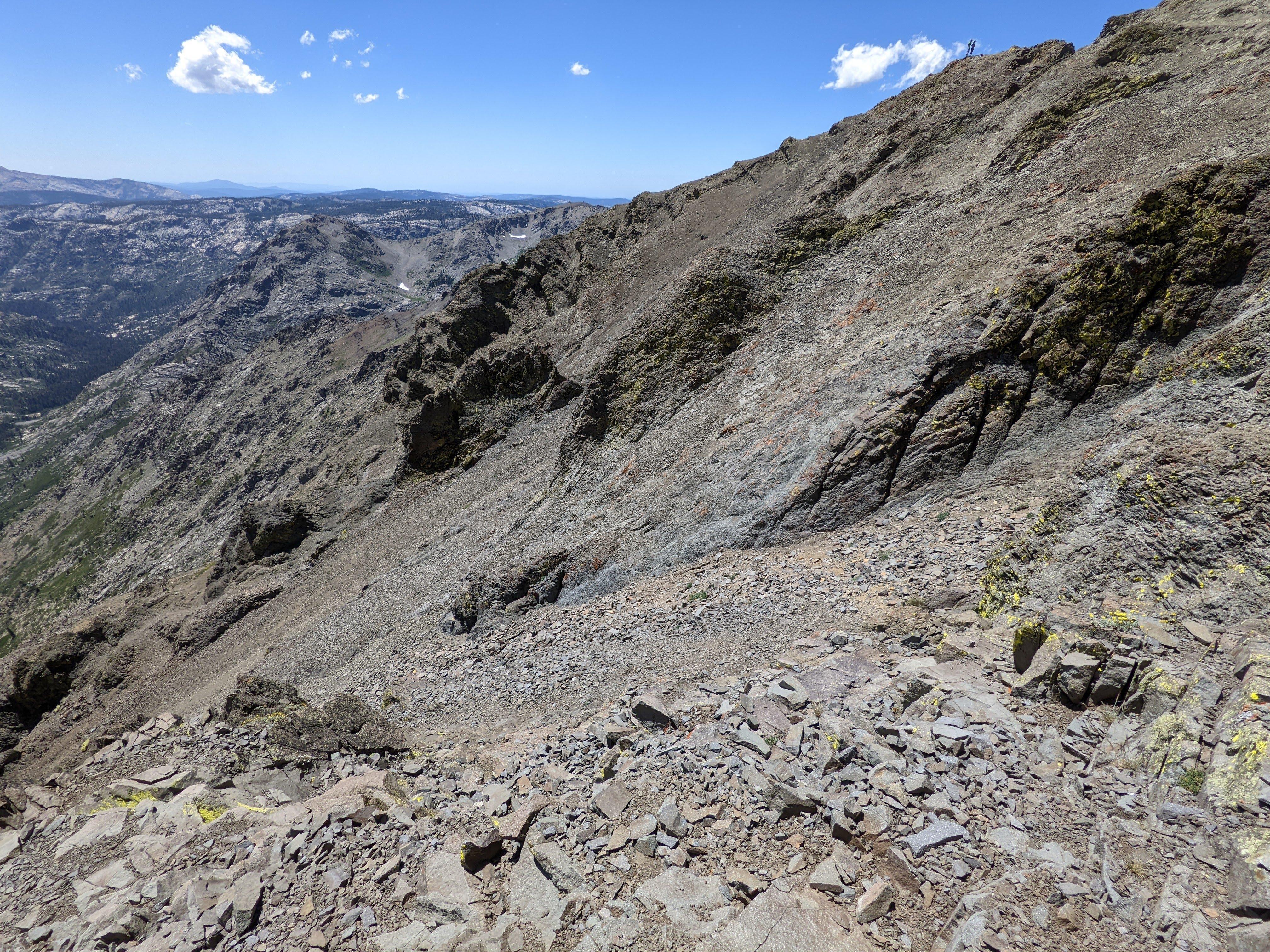
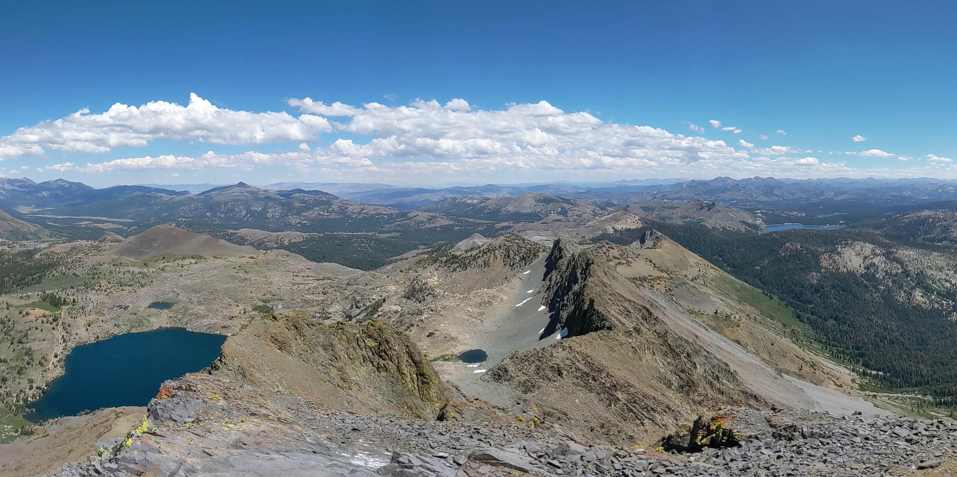
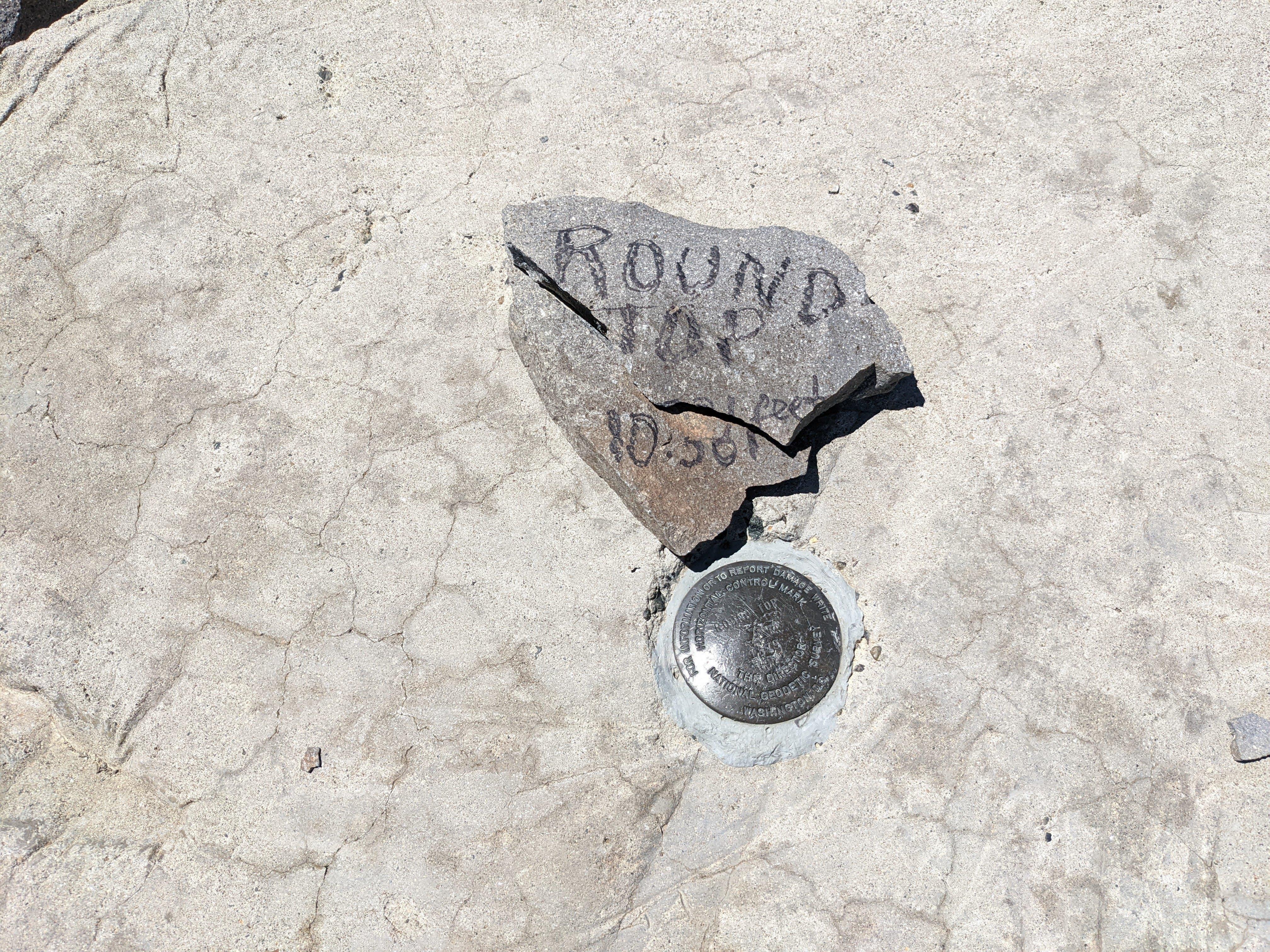
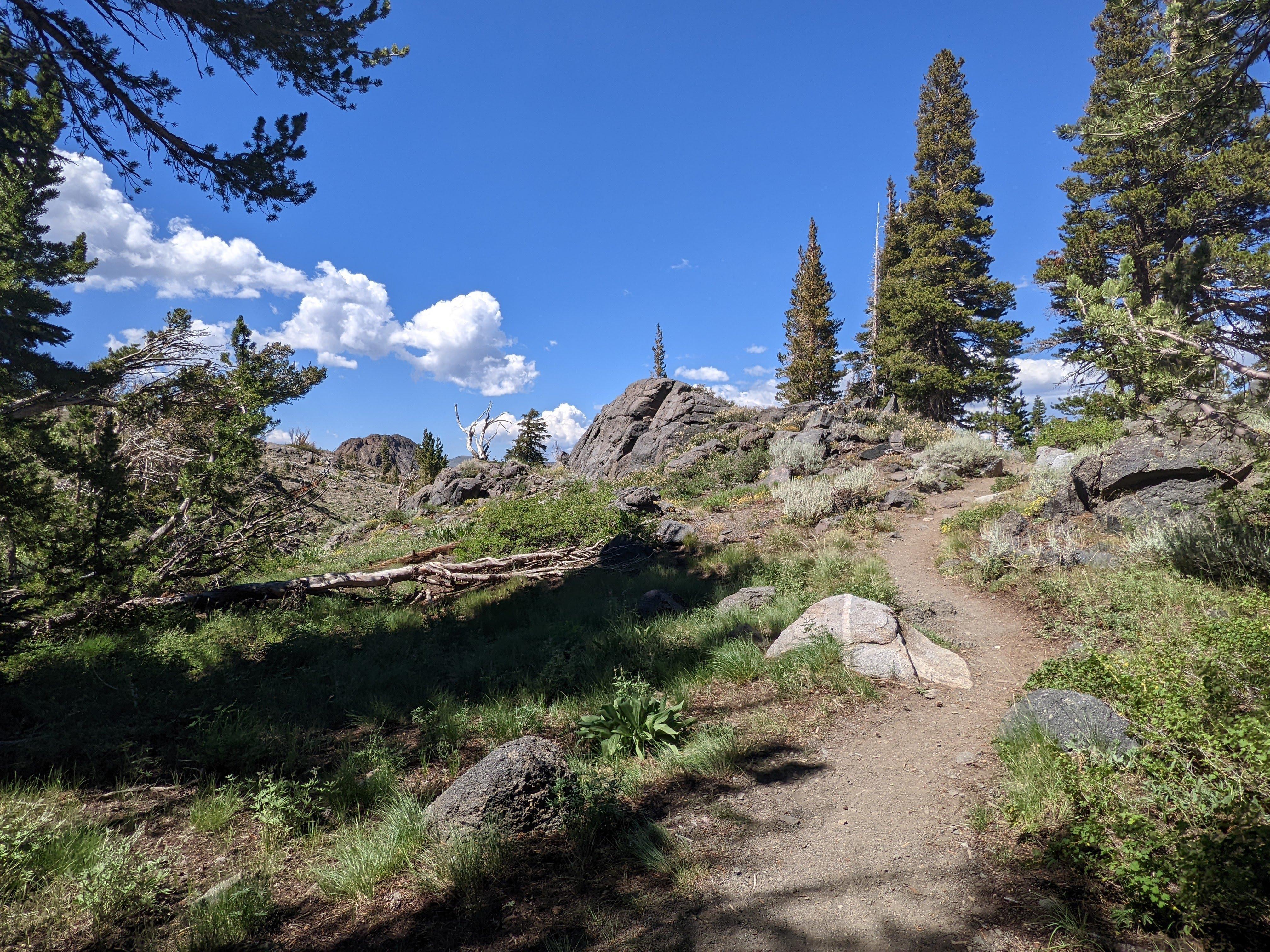
Winnemucca Lake Summit view toward East Summit view toward South East, Upper Blue Lake Summit view toward South West, Summit City Canyon (there is no City) Summit puck, look around for an ammo can with the summit journal The return leg of the hike is very picturesque Needs some paint job tho Blue, Green and Grey - in the vicinity of Black Butte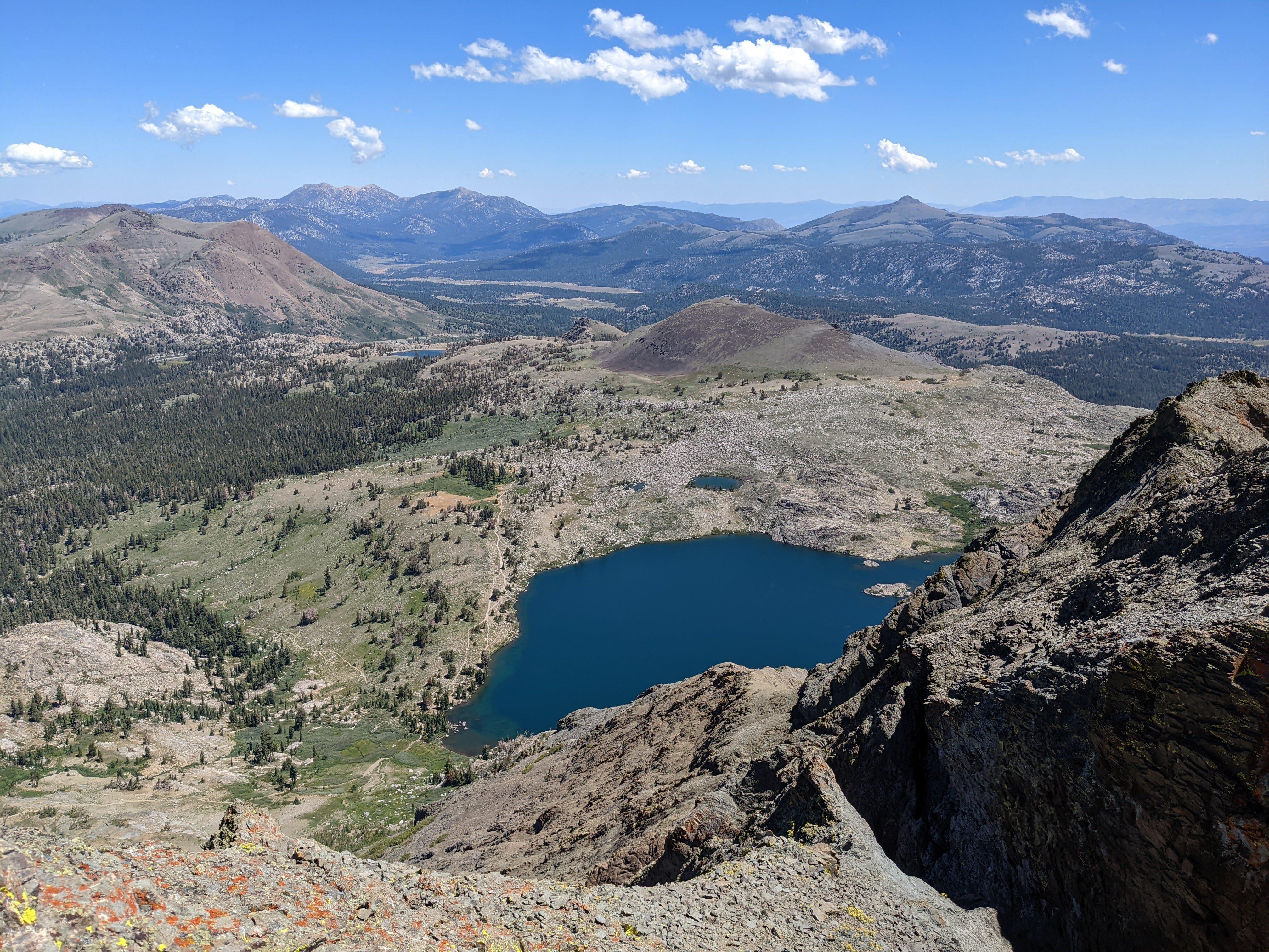
Didn’t expect so many wild flowers and lush vegetation in the mid August.
Near Woods Lake Campground Round Top as seen from Hwy 88 near the Carson Pass
Round Top aka W6/NS-055 SOTA activation
Now as you likely read and saw above there is a legit Class 3 scramble right before the summit. I didn’t want to do it with a hefty backpack and activated from the ridge next to the summit as you can see. This place is within 25 vertical meters / 80 feet SOTA activation zone.
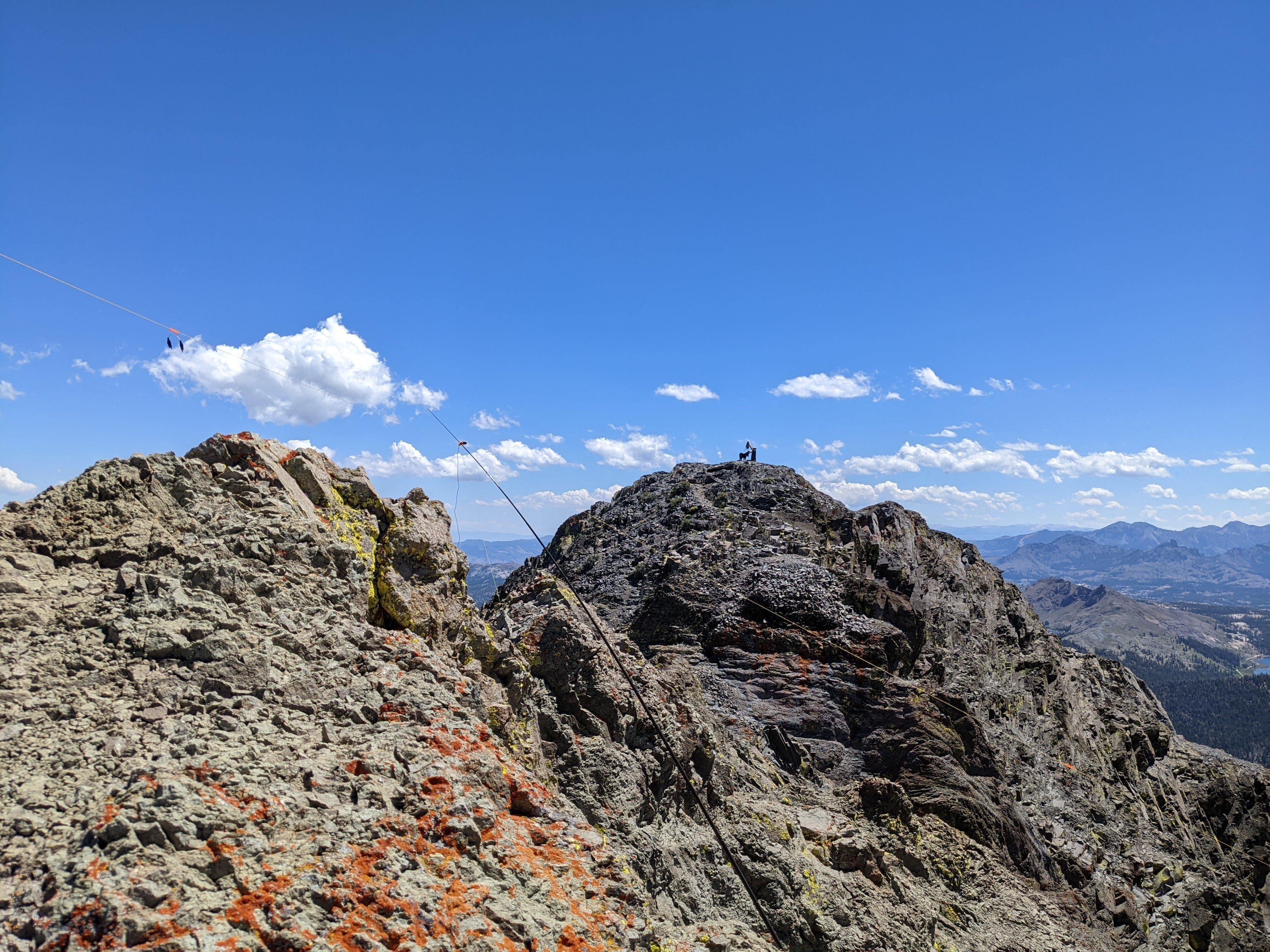
The top is quite round indeed - a dog and his man on the summit
I don’t really like my antenna deployment - there are no boulders on the ridge to tie to, I had to improvise around cracks. Also really didn’t want the mast blown away from the ridge so the antenna ended up fairly low with SWR around 2. Next time I’m going to try anchoring the antenna in a backpack.
On top of SOTA activation I had a WSPR beacon with me I tried with my dipole. Unfortunately no stations registered my WSPR calls so I’ll need to experiment more and figure out what was wrong with my setup.
Stations worked from Round Top
Thanks to all the chasers who helped to activate the mountain and to the folks I didn’t hear. I hope next time I’ll find a way to secure the mast better and answer you.
| Time UTC | Call sign | RST sent | RST received | Frequency | Mode | Maidenhead grid |
|---|---|---|---|---|---|---|
| 19:50 | WB6POT | 559 | 579 | 14.062 | CW | CM99 |
| 19:51 | W6CR | 449 | 459 | 14.062 | CW | CM96 |
| 19:52 | K7RV | 449 | 559 | 14.062 | CW | DM04 |
| 19:53 | KB7HH | 559 | 559 | 14.062 | CW | DM34 |
| 19:54 | K6YK | 229 | 229 | 14.062 | CW | CM97 |
| 19:55 | W4JKC | 229 | 229 | 14.062 | CW | EM84 |
| 19:55 | W0MNA | 599 | 599 | 14.062 | CW | EM29 |
| 19:56 | W0ERI | 599 | 599 | 14.062 | CW | EM29 |
This is all I have for today. 73 K0SSK out.